

Acum urmărești pe
A apărut o eroare la urmărirea utilizatorului.
Utilizatorul nu le permite altor utilizatori să-l urmărească.
Urmărești deja acest utilizator.
Planul tău de abonament permite doar 0 urmăriri. Alege un abonament superior apăsând aici .
Nu mai urmărești pe
A apărut o eroare la anularea urmăririi utilizatorului.
Ai recomandat pe
A apărut o eroare la recomandarea utilizatorului.
A apărut o eroare. Reîncarcă pagina și încearcă din nou.
Adresa de e-mail a fost confirmată.

lahore,
pakistan
Momentan, aici e ora 6:06 a.m.
S-a înregistrat pe iulie 13, 2017
0 Recomandări
Muneeb A.
@MUNEEBAAMIR
0,0
0,0
0%
0%
lahore,
pakistan
Indisponibil
Proiecte finalizate
Indisponibil
Conform bugetului
Indisponibil
La timp
Indisponibil
Rata de angajare repetată
Geospatial Expert
Discută cu Muneeb A. despre proiect
Conectează-te pentru a discuta pe chat despre detalii.
Portfoliu
Portfoliu


Preparation of Digital Elevation Model
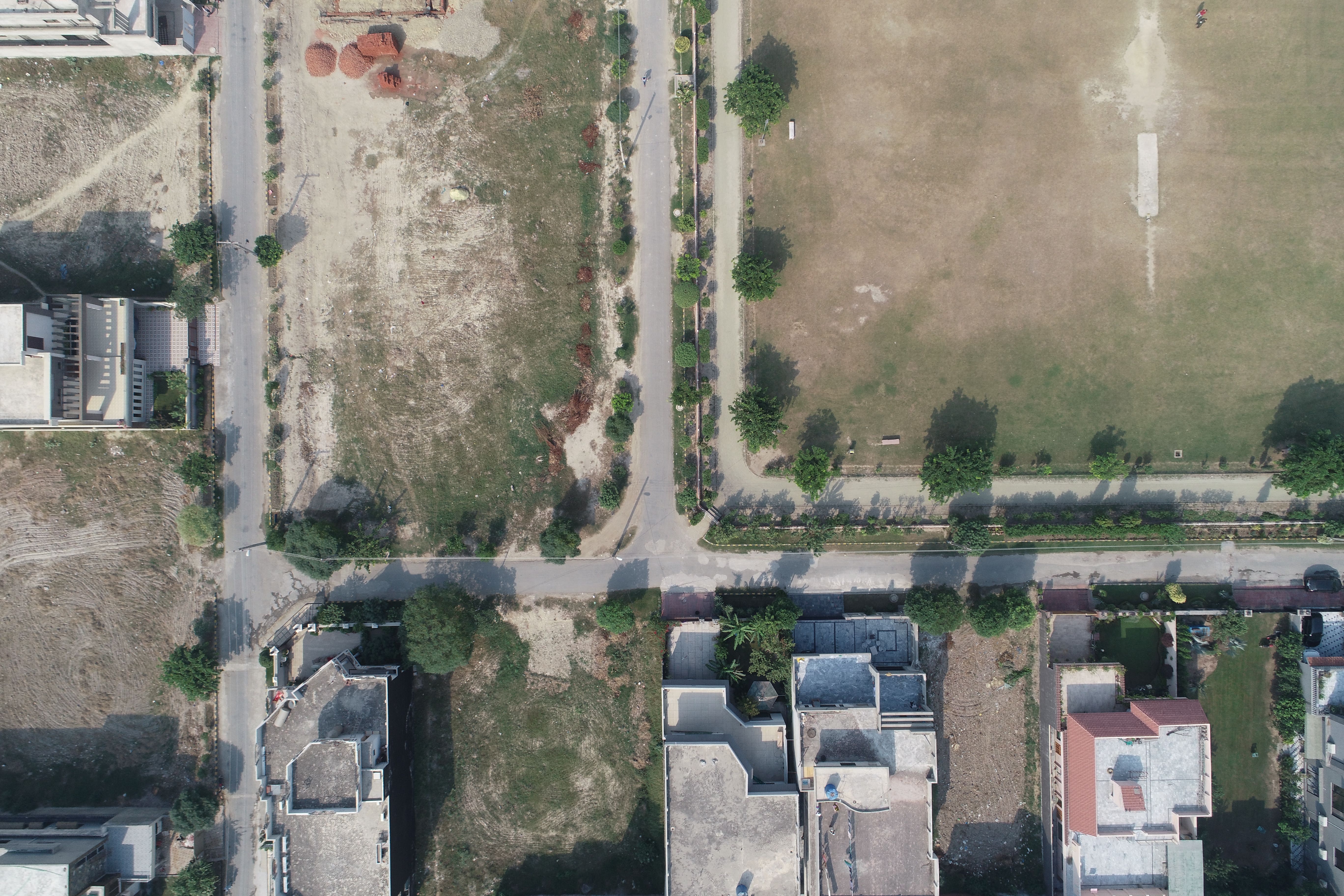

Drone Mapping

Drone Mapping

Drone Mapping
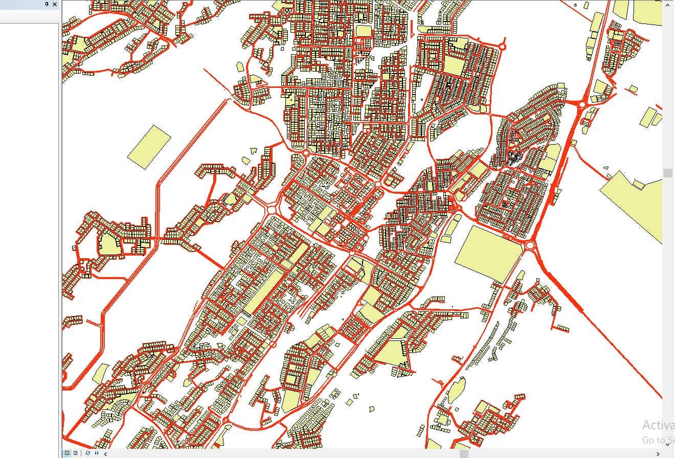

CAD to SHP Files

CAD to SHP Files
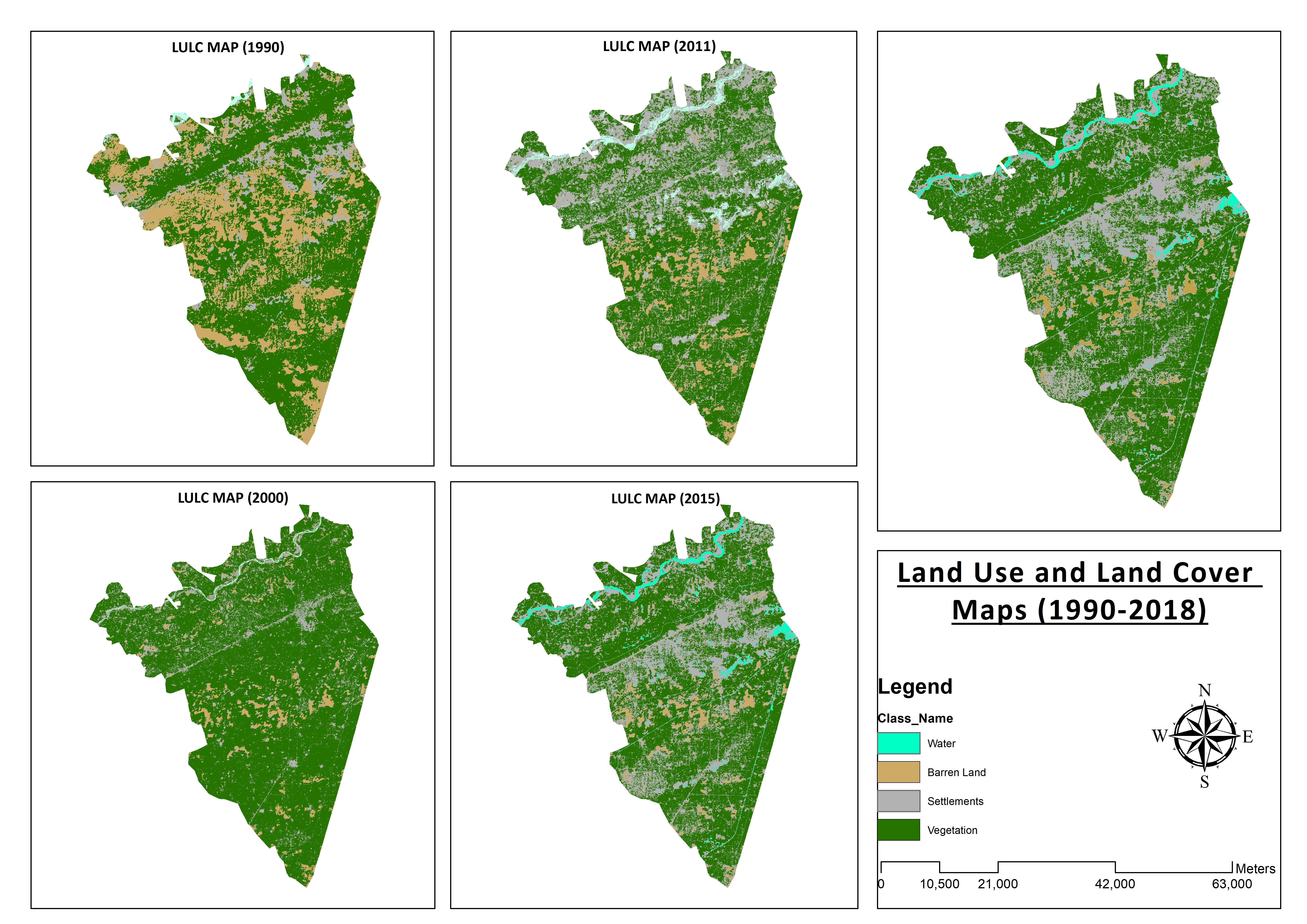

Land Use and Land Cover Maps
Preparation of Digital Elevation Model
Drone Mapping
Drone Mapping
Drone Mapping
CAD to SHP Files
CAD to SHP Files
Land Use and Land Cover Maps
Recenzii
Modificările au fost salvate
Nu există recenzii!
Experiență
Remote Sensing and GIS Analyst
sept. 2018 - oct. 2019 (1 an, 1 lună)
Developed, integrated and Implemented GIS and Geodesy based Topographic Survey Plans under different Hydro-Power Projects in Northern Pakistan, Extension of Canal Projects to increase its capacity in Sindh-Balochistan, Analysis of Suitable Site Selection for different development sites by using Drone for Aerial Mapping and their detailed pre-feasibility studies with different softwares, to analyse and interpret spatial data to produce interacting Maps and Reports while ensuring quality control.
Research Associate GIS
oct. 2015 - oct. 2018 (3 ani)
Deployed GIS-based system under Urban Immovable Property Tax (UIPT) for Punjab Excise & Taxation Department. Provided comprehensive support in creating the system while take advantage of software suites like ArcGIS Suite and ERDAS Imagine. Prepared communicating maps to help surveyors in Analyzing geo-spatial data to verify it during ground truthing. Created shapefiles to merge topographical data with external data through layering process.
Educație
Master of Philosophy in Geographic Information System
(2 ani)
Bachelors in Geographic Information System
(4 ani)
Calificări
MS-Office
TEVTA
2017
MS-Office Certification in MS-Word, Excel and Power Point.
Publicații
Analysis of Flood Damage Assessment through Different Satellite Datasets in Southern Punjab,Pakistan
International Journal of Innovations in Science & Technology
RS and GIS techniques can achieve the objectives and significant analyses through visual interpretations. These techniques are also used to identify the flood affected regions. The study site was examined by applying supervised classification determining that 16900.96 Hectors of agriculture land was damaged while Sparse Riverine Forest had the area 44.52 hectors. The damaged built-up area was 1805.78 Hectors.
Estimation of Net Rice Production by Remote Sensing and Multi Source Datasets
Sarhad Journal Of Agriculture
Estimation of net crop production before harvest enables agronomists and decision makers to determine the volume of grain precisely. Yield estimation is one of the challenging tasks which is significant to evaluate accurately for farmers. This research was conducted in eastern Punjab Pakistan by incorporating yield/area as reported by Crop Reporting Service Department along with open source satellite datasets.
Discută cu Muneeb A. despre proiect
Conectează-te pentru a discuta pe chat despre detalii.
Verificări
Cele mai bune aptitudini
Caută freelanceri similari
Caută prezentări similare
Invitația a fost trimisă!
Mulțumim! Ți-am trimis prin e-mail linkul pe care trebuie să-l accesezi pentru a revendica creditul gratuit.
A apărut o eroare la trimiterea e-mailului. Încearcă din nou.
Nu s-a putut efectua copierea în clipboard. Încearcă din nou după ce-ți ajustezi permisiunile.
S-a copiat în clipboard.
Se încarcă previzualizarea
S-a oferit permisiunea de depistare a locației.
Ți-a expirat sesiunea pentru conectare sau te-ai deconectat. Conectează-te din nou.